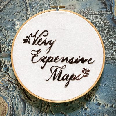
You get what you pay for: professional cartographer Evan Applegate interviews better cartographers. Listen to the best living mapmakers describe how they create worlds in pixels, ink, graphite, threads, film, paint, ceramic, wood and metal. For show notes and bonus content visit https://veryexpensivemaps.com
https://veryexpensivemaps.com
Gesamtlänge aller Episoden: 1 day 13 hours 54 minutes
episode 35: David Kulbeth: “It's taken so long to get everything just right because there's no guidebook to this.”
Stafford cartographer and entrepreneur David Kulbeth on reviving old map aesthetics with his digital-to-copperplate-to-print-to-watercolor technique, the (costly) difference between copperplate etching and engraving, finding a custom papermaker, keeping his art affordable, finding style inspiration in 12 moving boxes of cartography books, and making high-craft maps of “modern places in an antique style.” See his work at columbuscartography...
episode 34: Sophie Parr: “I have to mathematically scale it, plan it, sketch it, draw it.”
Fish Creek artist and gallery owner Sophie Parr on creating more than one hundred 0.5"-to-the-mile maps using aerial imagery and a 0.2mm-tip pen, why she only accepts 2x2" commissions (while working on her own 2x3 ft...
episode 33: Lee France: “It was fun to try to achieve those paper map elements in this new digital space.”
Sandpoint cartographer Lee France on making his first topos in Chile, spending months on a single map for National Geographic Trails Illustrated, the challenge of making an attractive interactive map that includes every scale from hilltop to hemisphere, how an up-to-date cadastral layer can make or break your hunting map, how his team of technical cartographers at OnX maintains three discrete map products, and the high-stoke activities his users get up to. See his work at leefrance...
episode 32: Gregor Turk: “I always focused on the map’s ability to simultaneously represent and distort reality.”
Atlanta visual artist, sculptor and “topophiliac” Gregor Turk on walking 250 miles of the U.S./Canada border, creating landscapes with clay, wood and recycled inner tubes, turning Landsat imagery into hundreds of hand-painted ceramic tiles, making 1:1 scale maps, chasing phantom streets, fighting real estate developers’ efforts to erase Blandtown, confusing Beltline tourists with “misinformation” wayfinding maps, and “pushing the idea of what a map can be.” See his work at gregorturk...
episode 31: Tom Patterson: “Right now is the golden age of cartography.”
Leesburg cartographer Tom Patterson on his decades creating visitor maps for the National Park Service (there’s a good chance his work is crumpled in your glovebox), learning to draw terrain by corresponding with an artist in Scotland, why he doesn’t lament the passing of 70s-era production techniques, how to map a piedmont glacier using satellite imagery, convincing the Park Service to give away their map files (then making it happen himself during a rained-out vacation), why he releases...
episode 30: Melinda Clarke & Deborah Young Monk: “The beauty of the whole project is that we had no idea what we were doing.”
St Leonards map producer/founder Melinda Clarke and Melbourne illustrator Deborah Young Monk discuss their collaborations across more than three decades, how to tell an artist they need to redraw three months of work, scouting territory by car, helicopter and hot air balloon, more than a week spent editing a 4x3 ft...
episode 29: Neil Gower: “Twice a week I’ll make a mark on paper and think ‘I wouldn’t want to be doing anything other than what I’m doing.”
Lewes/Berlin graphic artist and “exuberant mapmaker” Neil Gower on painting an estate plan when the grounds are unfinished, the work that gives him a “hum in the pelvis,” what Frank Zappa has in common with high-effort fake maps, an abandoned 5x5 ft...
episode 28: Andrew Lynch: “I wish somebody else had done this, but I guess I'm gonna have to figure it out.”
New York City cartographer and QueensLink chief design officer Andrew Lynch on using library archives, train-mounted GoPro footage and his own two feet to plot every track in the New York City subway system, a brush with cubicle-based urban planning at the Port Authority, testy-yet-productive correspondence with railfans, the unshakable authority conveyed by the Google Maps style, how your cartographic project should answer a question, and learning that the obstacle to building a subway...
episode 27: Danielle Currie: “Zoom in buddy, it ain’t paint!”
New Brunswick embroidery artist Danielle Currie discusses her fans among NASA’s Ocean Processing Group, spending more than 400 hours to render an Icelandic river in straight stitches, her hoops being mistaken for paintings, how you really have to enjoy the colors of a piece you’ll hold in your lap for months, pricing herself out of her own art, and not accepting commissions because “they’ll get it when they’re 80.” See her work at satellitestitches.com and instagram...
episode 26: Gabriel Camus: “That would be the dream, to make this city that never ends.”
Toronto architect and artist Gabriel Camus discusses the 20" wide, 20 ft. long imagined cityscape he’s been drawing since 2018, a 100 ft...